The regal Mount Edgecumbe, known as L’ux in Tlingit, stands about 15 miles west of town and can be seen from almost anywhere in Sitka.
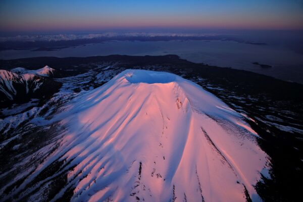
It’s often snow-covered crater gives it away as a volcano, and though it’s been considered dormant until recently, its past eruptions are likely the reason why Sitka’s lands are now inhabited. Daanax.ils’eik (Chuck Miller), the Culture and Community Liaison at Sitka Tribe of Alaska, tells how when the clans wanted to move their homeland, they migrated to what is now Baranof Island, Shee in Tlingit. Over 10,000 years ago they paddled through icy channels and could see flashing in the distance. As they drew closer, a sparking mountain came into view, and they knew then that the flashing was the eruption of a volcano. L’ux, the Tlingit word for the volcano, means “to flash or blink,” a fitting term for its discovery. Chuck Miller goes on to explain, “Because the ash and wind left the trees stunted inland, the clans first settled on the northeast side of Kruzof Island and then slowly moved to Sheet’ka.”
As an ancient reminder of discovery and a recent ground for activity, Mount Edgecumbe is both a symbol of beauty and change. The volcano’s base and crater top, as well as the surrounding vegetation of Kruzof Island, are meant for careful exploration and the tender reminder that this land is magisterial and, as the Tlingit regard it, sacred.
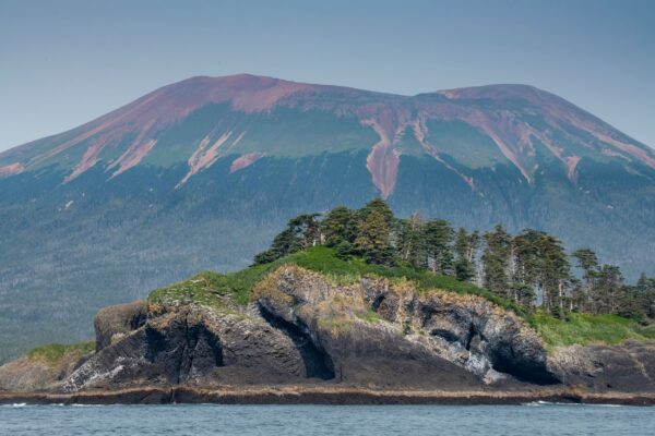
St. Lazaria Island with Mt. Edgecumbe in the background
Enjoy Edgecumbe Today
Today, the Tlingit and many other peoples inhabit the land, and in just a 30-minute boat ride across Sitka Sound, you can explore the volcano on Kruzof Island. Sitka Alaska Outfitters offers a guided ATV tour on Kruzof Island, where you’ll get the opportunity to view Alaska brown bears in the wild.
Tucked among the trees, just back from the rocky beach, is Fred’s Creek Cabin, a federal recreation facility that’s available to rent year-round. Camping and beachcombing are at your fingertips, and bears are often spotted walking the shoreline. This cabin, on the southeastern shore of Kruzof, is only 50 yards from the trailhead leading up to Mount Edgecumbe.
Explore the Summit
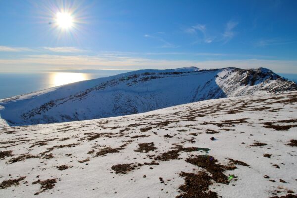
Sitka Trail Works explains that hikers can summit the volcano after an elevation gain of 3,200 feet. The nearly 7-mile (one-way) hike begins through muskeg, taiga forests, and muddy pathways. Once you pass the timberline, the terrain becomes barren and the trail steep. The rest of the hike is marked by cedar posts that are necessary guides if the fog rolls in and visibility becomes low. When you hike on a clear day, climbers are encouraged to trek any way to the top to help alleviate repetitive foot traffic. The commanding views from the top make the strenuous hike well worth it. The sights of the nearby caldera, vast ocean, and the tentacle-like pattern of the trees descending the mountain will properly ground you-or leave you feeling weightless.
Alpenglow Adventures, a new addition to the guided hike scene, is also offering summit hikes. Alpenglow’s signature experience is an all-inclusive 14-mile guided hike of Mt. Edgecumbe, This package includes the transfer to Kruzof Island, meals, and all the gear you need. This hike is only available on select dates, so book your trip early!
Recent Rumblings
When you walk the grounds of Mount Edgecumbe, you witness firsthand how powerful land formation is. In fact, there has been recent activity beneath its surface. In April of 2022, a swarm of earthquakes began under this stratovolcano. Though these disruptions don’t necessarily signal an imminent eruption, the Alaska Volcano Observatory did place a seismometer and GPS sensor on Kruzof to monitor and measure deformation beneath the surface. These earthquakes are likely due to movement of magma beneath and may not lead to an eruption, but since the volcano does not have a history of small earthquakes, monitoring is needed to discover the true origins of these recent activities.
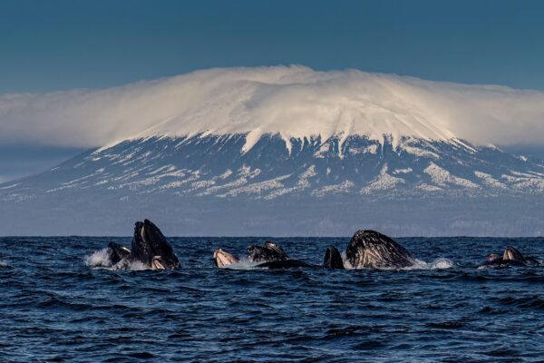
Whales bubble net feeding in front of the volcano